
 NASA has started the countdown for the 15 December SpaceX launch of the international Surface Water and Ocean Topography (SWOT) mission to survey nearly all water on Earth’s surface for the first time.
NASA has started the countdown for the 15 December SpaceX launch of the international Surface Water and Ocean Topography (SWOT) mission to survey nearly all water on Earth’s surface for the first time.
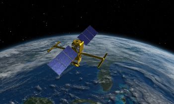
Photo credit NASA: An artist’s concept of the SWOT spacecraft
The SWOT Water Survey Mission will help to track how fresh and saltwater bodies change over time.
The mission is targeted for lift-off at 6:46 a.m. EST (3:46 a.m. PST) Thursday 15th December on a SpaceX Falcon 9 rocket from Space Launch Complex 4-East at Vandenberg Space Force Base in California.
SWOT will survey nearly all water on Earth’s surface for the first time, measuring the height of the world’s oceans, rivers, and lakes, helping scientists track how fresh and saltwater bodies change over time.
The satellite will help scientists investigate how the oceans absorb atmospheric heat and carbon, moderating global temperatures and climate change.
Using SWOT’s state-of the-art technology, scientists will observe ocean features with 10 times the resolution of current technologies along with providing high-definition views of freshwater bodies. It can observe the entire length of nearly all rivers wider than 330 feet (100 meters), as well as collect data on more than a million lakes larger than 15 acres (62,500 square meters).
The satellite will survey at least 90 percent of the globe, studying Earth's lakes, rivers, reservoirs and oceans at least twice every 21 days to improve ocean circulation models, and weather and climate predictions, and aid in freshwater management around the world.
NASA said that a global inventory of water resources will help scientists better understand:
- where the water is
- where it’s coming from
- where it’s going
The observations will help to improve flood forecasts, improving the models used to monitor droughts and improving predictions for sea level rise. The observations also will benefit industries, like shipping, by providing measurements of water levels along rivers, as well as information about tides, currents, and storm surges in the ocean.
The mission is a collaborative effort by NASA and the French space agency Centre National d’Etudes Spatiales (CNES) with contributions from the Canadian Space Agency (CSA) and the UK Space Agency.
Individuals and organisations can register to attend the SWOT launch virtually. The virtual guest program for this mission includes curated launch resources, notifications about related opportunities or changes, and a stamp for the virtual guest passport following a successful launch.
Click here to follow countdown coverage on the SWOT launch blog
Click here to register to attend the SWOT launch virtually.


Sign In
